
Maumakeogh [Mam an Cheo]
Good walks are even better shared.
Overview
Maumakeogh [Mam an Cheo]
Maumakeogh, locally known as Mam an Cheo, is a splendid peak nestled in the Galway Mountains, standing at an impressive 542 meters. Tucked away in the west of Ireland, this relatively lesser-known hill is a gem waiting to be discovered by outdoor enthusiasts.
Geology
The mountain's rugged charm stems from its quartzite composition, remnants of ancient sedimentary rock transformed by the power of nature. The craggy outcrops and steep slopes provide not just a challenge for hikers but also enchanting visual appeal. As you traverse the area, keep an eye out for glacial features that tell the story of the landscape's dramatic past.
Routes
- Maumakeogh Circuit: This 8 km circular route is an excellent option for those looking to experience a bit of everything. You'll tackle some steep inclines, get your heart racing, and be rewarded with unparalleled views of the rolling hills and valleys below.
- Straight Ascent from the East: If you're short on time, this 4.5 km straight ascent is the way to go. It's steep but manageable, and once you reach the top, you'll be in for a treat.
Summit Features
The summit greets you with a sturdy stone cairn and commanding views that stretch far and wide. On a clear day, the 12 Bens range looks majestic, and the rugged beauty of Connemara is a sight for sore eyes. Make sure to capture a selfie from this vantage point!
Terrain Type
Expect a mix of rocky outcrops and grassy slopes with occasional boggy patches. Sturdy footwear is recommended as you navigate the undulating terrain.
Views
The vistas from Maumakeogh are nothing short of spectacular! You’ll see the Twelve Bens, Lough Corrib and even the distant Connemara coastline on a clear day. Late spring and early autumn are the prime times for visiting when the wildflowers bloom and the skies are at their bluest.
Hazards
While the hike is delightful, it’s essential to keep an eye on the ever-changing weather—bring layers to keep warm, and watch out for those pesky loose rocks that might want to play a game of hopscotch with your ankles.
Nearby Summits
A short jaunt from Maumakeogh leads you to other peaks, such as Bencorr and Benbaun—perfect for those who are keen to bag a few more summits on their adventure.
Access
If you're driving, there's a handy parking area at G045 353, but do arrive early to nab a spot. Public transport options are sparse; a car is the best bet for reaching the trailhead. The quaint village of Leenane is just a stone's throw away, offering cafes and shops—ideal for post-hike refreshments.
Facilities
On the mountain, you'll find no facilities, but fear not! Leenane provides all the essentials, including eateries and public toilets to freshen up after your trek.
History
The name Maumakeogh means 'the hill of the mist', reflecting the often cloud-covered summit. This mountain is integral to the local lore, holding cultural significance for many.Its slopes whisper tales of the past, making each footfall on its terrain feel like stepping into history.
In conclusion, Maumakeogh is a treasure trove for hikers looking for adventure, stunning landscapes, and a bit of Irish heritage. Whether you’re a seasoned hillwalker or just fancy a leisurely jaunt, this mountain promises not to disappoint.
Conclusion
So pack your bag, lace up those boots, and set off for Maumakeogh—an adventure awaits! Don’t forget your camera; you’ll want to capture the memories (and the views!) before returning to the joys of civilised life.
Explore routes near Maumakeogh [Mam an Cheo]
Public walks starting within 80 km of this hill. Nearby does not mean a route reaches the summit; check its map and access before setting out.
No public routes are currently listed within 80 km of Maumakeogh [Mam an Cheo] on Walkmates. This does not mean there are no paths here. Explore the map and check local access information before planning a walk.
Route planning notes
These notes describe possible approaches, not verified navigable routes or permission to cross land. Check current paths, local access rules and conditions before setting out.
Maumakeogh Circuit
A circular route starting from the small parking area adjacent to the Maumturk mountains, offering a blend of challenging inclines and stunning vistas.
Straight Ascent from the East
A straightforward ascent directly from the valley, providing an exhilarating climb with breathtaking views but a steep gradient.
Make a day of it, together
Find someone to share the walk with, or organise a day out along a route you like.
Hill facts and local notes
Classifications
Elevation
379m
1,243 ft
Prominence
294m
Coordinates
54.2710, -9.4789
G037368
OS Map
23
At the Summit
At the summit, hikers will find a large stone cairn and expansive views over the surrounding mountains and valleys, making it a popular spot for a well-deserved break or sandwich photo opportunities.
Terrain & Geology
The mountain is primarily composed of quartzite, formed from ancient sedimentary rocks that have undergone significant metamorphism, giving it a rugged appearance. The surrounding landscape features glacial tills and moraines, shaping the scenic valleys below.
Views & Scenery
From the summit, you can see the Twelve Bens mountain range, Lough Corrib, and, on a clear day, the distant Connemara coastline.
History & Heritage
Name Origin
The name 'Mam an Cheo' translates to 'the hill of the mist' in Irish, aptly reflecting the often cloudy conditions that blanket the peak.
Historical Significance
The mountain is part of the ancient landscape of Connemara, steeped in Irish folklore and serving as a sacred site for local communities.
Getting There & Facilities
Check current local access restrictions, parking rules and transport timetables before travelling. These notes do not confirm public access to the summit.
Parking
There is a small parking area at G045 353, which can accommodate a few cars. Arriving early is advised as it fills up quickly on weekends.
Public Transport
Public transport options are limited; the nearest bus service operates from Galway City with infrequent stops. A car is the ideal mode of transport.
Nearby Facilities
There are no facilities on the mountain itself. However, Leenane offers cafes, shops, and public toilets.
Safety Information
Known Hazards
- Watch out for sudden weather changes; the conditions can shift from sunny to rain in a blink. Also, be cautious of loose rocks on the ascent.
General Safety Tips
- Check weather conditions before setting out
- Carry appropriate clothing and equipment
- Let someone know your planned route
- Take a map, compass, and GPS device
- Carry emergency supplies: food, water, first aid kit, torch
Hills
Some common questions about the hills answered
Are there group walks up Maumakeogh [Mam an Cheo]?
Many walkers use Walkmates to join or organise walks with others. You can check for group walks around Maumakeogh [Mam an Cheo] through the maps
Are there other walkers around Maumakeogh [Mam an Cheo]?
Activity varies by location and time, but Walkmates lets you see whether others have shared walks or shown interest in this area. Find other people through the walking friends search walking friends for Maumakeogh [Mam an Cheo] search or of course create your own walk for Maumakeogh [Mam an Cheo]
Can I organise a walk to Maumakeogh [Mam an Cheo]?
Yes. If there aren’t any walks listed already, you can create a walk and make it available for others to join.
If you're signed up to Walkmates, you can create a walk to Maumakeogh [Mam an Cheo].
How do I find a walk up this hill?
There are often multiple ways to walk this hill, depending on experience and route preference. Walkmates helps you explore walks and routes that others have shared.
Can I suggest a new route up Maumakeogh [Mam an Cheo]?
Yes. You can suggest or create routes to share with others. Walkmates focuses on the social side of walking, so routes are used to help people organise walks and explore areas together, rather than as detailed navigation tools or route libraries.
Other uses really appreciate knowledgeable walkers sharing their routes. Share your favourite route to Maumakeogh [Mam an Cheo] here
The is an error or something incorrect about this hill. How do I let you know?
We always strive to keep the information on Walkmates as accurate as possible. If you find an error, please let us know through the contact form and we'll aim to correct it as quickly as possible
Community Discussion
Comments
Location
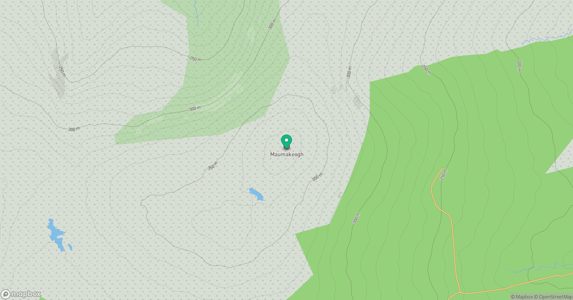
Grid reference: G037368
View on OpenStreetMapOpens a map in a new tab, centred on the hill.
Hills within 30 km
Straight-line distance, not a walking route or confirmation of access.
No comments yet. Be the first.